


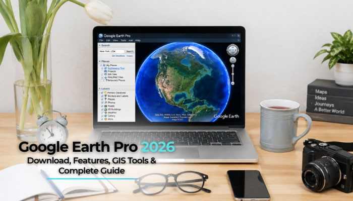

Google Earth Pro remains one of the most useful free desktop mapping tools for exploring satellite imagery, checking historical imagery, importing GIS data, measuring land, creating KML and KMZ projects, and studying locations in 3D.
For researchers, GIS professionals, students, property researchers, planners, educators, and everyday users, Google Earth Pro provides more advanced desktop tools than basic map browsing.
Google currently lists Google Earth Pro 7.3.7 for Windows, Mac, and supported Linux distributions. An important change is also approaching: Google says new downloads of the desktop application will end on June 25, 2027. Existing installations can continue working after that date.
This complete Google Earth Pro guide covers downloading, installation, system requirements, historical imagery, GIS tools, GeoJSON, shapefiles, KML and KMZ, coordinates, GPS data, measurements, elevation profiles, troubleshooting, and the 2027 transition.
Quick Answer: Google Earth Pro
Google Earth Pro is Google’s free desktop geographic visualization application. It combines satellite and aerial imagery with advanced mapping tools for historical imagery, GIS imports, KML/KMZ projects, GeoJSON, GPS data, measurements, Street View, 3D terrain, elevation profiles, Viewshed analysis, image overlays, Movie Maker, and more.
The current listed version is Google Earth Pro 7.3.7.
In 2026, users can still download the software for supported desktop platforms. Google plans to stop offering new downloads beginning June 25, 2027, but existing installations can continue afterward.
Google Earth Pro at a Glance
| Feature | Details |
| Current version | Google Earth Pro 7.3.7 |
| Price | Free |
| Windows support | Yes |
| macOS support | Yes |
| Linux support | Yes |
| Historical imagery | Yes |
| Street View | Yes |
| GIS imports | Yes |
| KML/KMZ | Yes |
| GeoJSON | Yes |
| Shapefile import | Yes |
| GPS import | Yes |
| Measurements | Yes |
| Elevation profiles | Yes |
| Viewshed | Yes |
| Movie Maker | Yes |
| New downloads end | June 25, 2027 |
| Existing installations afterward | Can continue |
Key Takeaways
- Google Earth Pro remains free in 2026.
- Google currently lists version 7.3.7.
- The desktop software supports Windows, Mac, and several Linux distributions.
- Google Earth Pro includes historical imagery.
- GIS users can import CSV, shapefiles, GeoJSON, GeoTIFF, and other geographic data.
- KML and KMZ remain important Google Earth project formats.
- Google Earth Pro can measure distance, area, circumference, and some 3D features.
- Elevation profiles help users analyze terrain.
- GPS data can be imported into Google Earth Pro.
- Google Earth imagery is not a live satellite feed.
- New Google Earth Pro downloads end June 25, 2027.
- Existing installations can continue after the download cutoff.
What Is Google Earth Pro?
Google Earth Pro is the traditional desktop version of Google Earth.
It allows users to explore locations around the world using satellite imagery, aerial photography, Street View, terrain data, 3D imagery, and geographic information.
Google Earth Pro also includes tools for creating and managing geographic projects.
Users can:
- Create placemarks
- Draw paths
- Create polygons
- Measure land
- Import GIS data
- Open KML and KMZ files
- Import GPS information
- Examine historical imagery
- Create elevation profiles
- Add image overlays
- Save map images
- Record geographic tours
The software is especially useful when users want to combine Google’s imagery with their own geographic data.
Who Should Use Google Earth Pro?
Google Earth Pro can be useful for many different types of users.
These include:
- GIS professionals
- Researchers
- Students
- Teachers
- Real estate professionals
- Property researchers
- Urban planners
- Environmental researchers
- Journalists
- Archaeologists
- Construction professionals
- Field researchers
- Travel planners
- Government agencies
- Mapping enthusiasts
Google Earth Pro is particularly useful for visualization and preliminary geographic research.
However, it should not replace professional surveying, engineering data, legal property records, cadastral information, or high-precision GIS analysis when accuracy is critical.
Is Google Earth Pro Free in 2026?
Yes.
Google Earth Pro is free to download and use.
The software once had paid professional licensing, but normal desktop users no longer need to purchase a Pro subscription.
This makes Google Earth Pro attractive for students, researchers, small businesses, GIS users, and anyone who needs advanced mapping tools without paying for a separate desktop license.
Google Earth Pro Download in 2026
The safest way to download Google Earth Pro is through Google’s official Google Earth website.
Current desktop options include:
| Platform | Google Earth Pro Availability |
| Windows 32-bit | Available |
| Windows 64-bit | Available |
| macOS | Available |
| Debian/Ubuntu Linux 64-bit | Available |
| Fedora/openSUSE Linux 64-bit | Available |
The latest listed release is:
Google Earth Pro 7.3.7
Users should avoid unfamiliar third-party download websites when the official Google installer is available.
How to Download Google Earth Pro
Follow these steps:
- Open Google’s official Google Earth website.
- Find the option for Google Earth Pro on desktop.
- Select the correct installer for your computer.
- Download the installer.
- Open the downloaded file.
- Follow the installation instructions.
- Launch Google Earth Pro.
- Allow internet access if a firewall blocks the application.
For most users, installing the newest supported version is preferable to using an old release.
Latest Google Earth Pro Version
The latest listed 7.x desktop version in 2026 is:
Google Earth Pro 7.3.7
This version includes improvements related to KML compatibility, measurement settings, Linux support, GeoTIFF workflows, and other fixes.
Users running much older versions should consider updating because some features and services may require newer releases.
For example, Street View inside Google Earth Pro requires a sufficiently recent version.
Google Earth Pro 7.3.7 Features and Improvements
Google Earth Pro 7.3.7 includes improvements such as:
- Better compatibility with newer KML files
- Improved styling support
- More consistent measurement settings
- Linux startup fixes
- Better GeoTIFF export workflows
- Improved KMZ compatibility
- General bug fixes
These changes are particularly useful for people who exchange geographic projects between the classic desktop application and newer Google Earth environments.
Important Google Earth Pro 7.3.6 Features
Several important features arrived in version 7.3.6 and remain useful in Google Earth Pro 7.3.7.
These include:
- GeoJSON importing
- Improved Movie Maker
- Hardware-accelerated video encoding
- HEVC/H.265 support
- Historical imagery navigation while recording
- Street View navigation during recording
- Improved printing
- Larger Save Image output
- Improved high-DPI support
- Better CSV handling
- Regionate improvements
These updates significantly expanded the usefulness of Google Earth Pro for GIS and presentation workflows.
Google Earth Pro System Requirements
Before installing Google Earth Pro, make sure your computer meets the basic requirements.
Windows Requirements
| Component | Minimum | Recommended |
| Operating system | Windows 7 | Windows 7 or newer |
| Processor | 1 GHz | 2 GHz dual-core or faster |
| RAM | 2 GB | 4 GB |
| Storage | 2 GB | 4 GB |
| Internet | Required | High-speed |
| Graphics | DirectX 9 or OpenGL 1.4 | DirectX 11 or OpenGL 2.0 |
Mac Requirements
Typical minimum requirements include:
- Compatible macOS version
- Intel 64-bit processor
- At least 2 GB RAM
- At least 2 GB storage
- Internet connection
- OpenGL-compatible graphics
More RAM and faster graphics generally provide smoother Google Earth Pro performance.
Linux Requirements
Google Earth Pro is available for supported Linux distributions, including packages designed for Debian/Ubuntu and Fedora/openSUSE environments.
Users generally need:
- AMD64-compatible processor
- At least 2 GB RAM
- Available storage
- Internet connection
- Compatible OpenGL graphics
Linux compatibility can vary by distribution and hardware configuration.
Best Google Earth Pro Features
Google Earth Pro includes far more than basic satellite imagery.
| Feature | Main Purpose |
| Satellite imagery | Explore locations from above |
| Aerial imagery | View detailed overhead photography |
| Historical imagery | Compare locations across time |
| Street View | Explore ground-level imagery |
| 3D terrain | Examine geographic elevation |
| 3D buildings | View supported places in 3D |
| Placemarks | Save locations |
| Paths | Draw routes |
| Polygons | Outline geographic areas |
| GIS importing | Add external data |
| KML/KMZ | Store and share map projects |
| GeoJSON | Import modern geographic data |
| GPS support | Import routes and tracks |
| Ruler | Measure distance and area |
| Elevation profile | Analyze terrain |
| Viewshed | Estimate visible areas |
| Image overlays | Add external maps |
| Movie Maker | Record geographic video |
| Save Image | Export map views |
| Flight Simulator | Explore Earth virtually |
Google Earth Pro Historical Imagery
Historical imagery is one of the biggest reasons many people continue to use Google Earth Pro.
Instead of viewing only the default imagery for a location, users can examine older satellite or aerial images when they are available.
Historical imagery can help users research:
- Urban growth
- New roads
- Building construction
- Demolition
- Property development
- Deforestation
- Agricultural change
- Coastline movement
- Infrastructure expansion
- Disaster damage
The amount of historical imagery available varies by location.
Some places have many different imagery dates, while others have only a few.
How to View Historical Imagery in Google Earth Pro
To check older imagery:
- Open Google Earth Pro.
- Search for a location.
- Zoom to the area you want to study.
- Select the Historical Imagery clock icon.
- Wait for the timeline to appear.
- Move the slider through the available dates.
If a specific year does not appear, Google Earth Pro does not currently have selectable imagery for that year and location.
How Old Is Google Earth Pro Imagery?
Google Earth Pro imagery is not necessarily current.
Some areas may have relatively recent imagery, while others may be several years old.
The age depends on:
- Location
- Imagery provider
- Collection schedule
- Weather conditions
- Image quality
- Processing
- Availability
For time-sensitive research, always check the imagery date before assuming the visible map reflects current conditions.
How to Check the Imagery Date
Google Earth Pro can display imagery-date information when that information is available.
However, users should understand that one visible map can sometimes be created from several images captured at different times.
For this reason, an imagery date may represent:
- One capture date
- A date range
- Different dates across nearby locations
- No single date for certain 3D imagery
Checking the date is particularly important when using Google Earth Pro for property research, construction analysis, journalism, or environmental comparisons.
Is Google Earth Pro Live?
No.
Google Earth Pro does not normally show live satellite imagery.
The imagery comes from satellite, aerial, Street View, and 3D collection systems and is processed before being displayed.
This means Google Earth Pro should not be treated as a live surveillance or real-time satellite service.
The application can, however, work with real-time GPS location information from compatible equipment while displaying that position over previously collected imagery.
Satellite vs Aerial vs Street View vs 3D Imagery
Google Earth Pro combines several types of imagery.
Satellite Imagery
Satellite imagery is captured from Earth-observation satellites.
It is useful for viewing large geographic areas.
Aerial Imagery
Aerial imagery is normally captured from aircraft.
It may offer more detailed views in supported locations.
Street View
Street View provides ground-level panoramic photography.
It can help users examine roads, buildings, intersections, businesses, and neighborhoods.
3D Imagery
3D imagery combines geographic data and photography to represent terrain and buildings from different angles.
The quality of Google Earth Pro 3D coverage varies by location.
Can You Request New Google Earth Pro Imagery?
Users can submit feedback about outdated imagery.
However, requesting an update does not guarantee that Google will immediately provide new imagery.
Imagery availability depends on factors such as:
- Geographic coverage
- Supplier availability
- Collection schedules
- Processing
- Cloud cover
- Image quality
If recent imagery is critical, a specialist commercial satellite or aerial imagery provider may be more appropriate.
Google Earth Pro GIS Tools
GIS support is one of the strongest features of Google Earth Pro.
Users can combine Google imagery with external geographic information.
Examples include:
- Coordinates
- Addresses
- Points
- Lines
- Polygons
- Shapefiles
- GeoJSON
- Raster imagery
- GPS data
- Spreadsheet locations
This makes Google Earth Pro useful as a visualization companion to more advanced GIS platforms.
Google Earth Pro Supported File Types
| Format | Common Use |
| KML | Google geographic data |
| KMZ | Compressed Google Earth project |
| CSV | Spreadsheet location data |
| TXT | Text-based data |
| SHP | ESRI shapefile |
| GeoJSON | Geographic vector data |
| GeoTIFF | Georeferenced imagery |
| TIFF | Raster imagery |
| NTF | Geographic imagery |
| IMG | Raster GIS data |
| GPX | GPS tracks |
| LOC | GPS location data |
Not every format supports every feature, so imported information should always be checked after loading.
Import CSV Data Into Google Earth Pro
Google Earth Pro can convert spreadsheet data into map locations.
For example:
| Location | Latitude | Longitude |
| Location A | 40.7128 | -74.0060 |
| Location B | 34.0522 | -118.2437 |
| Location C | 41.8781 | -87.6298 |
To import CSV data into Google Earth Pro:
- Open Google Earth Pro.
- Select File → Import.
- Choose the CSV file.
- Select the correct delimiter.
- Identify latitude and longitude fields.
- Review the data preview.
- Complete the import.
Imported points can then appear as placemarks.
Import Address Data Into Google Earth Pro
Google Earth Pro can also work with spreadsheet-based address data in supported regions.
This can be useful for mapping:
- Customers
- Offices
- Stores
- Properties
- Research locations
- Field sites
Before importing a large dataset, make sure addresses follow a consistent format.
Import Shapefiles Into Google Earth Pro
Google Earth Pro supports ESRI shapefile data.
A shapefile project may include several related files:
- .shp
- .shx
- .dbf
- .prj
Keep these files together when importing data.
Separating the files can cause missing geometry, attributes, or coordinate information.
Can Google Earth Pro Import GeoJSON?
Yes.
Google Earth Pro supports GeoJSON importing.
GeoJSON is commonly used for storing:
- Points
- Lines
- Polygons
- Multi-geometries
- Geographic attributes
This is useful for developers and GIS users who work with web mapping systems.
Import GeoTIFF Into Google Earth Pro
Google Earth Pro can display georeferenced raster imagery such as GeoTIFF files.
GeoTIFF data can contain geographic positioning information that helps Google Earth Pro place the image correctly.
Potential uses include:
- Historical maps
- Environmental imagery
- Remote-sensing data
- Planning maps
- Survey imagery
Users should still confirm that projections and coordinates are compatible.
KML and KMZ in Google Earth Pro
KML and KMZ are central to Google Earth Pro workflows.
KML stands for Keyhole Markup Language.
It can contain:
- Placemarks
- Coordinates
- Paths
- Polygons
- Camera positions
- Styles
- Labels
- Descriptions
- Image overlays
KMZ is a compressed package that can contain KML plus supporting files.
KML vs KMZ
| KML | KMZ |
| XML-based geographic file | Compressed package |
| Easier to edit manually | Easier to share |
| May reference external resources | Can bundle project resources |
| Good for development | Good for distribution |
For complex Google Earth Pro projects containing custom icons or images, KMZ is often more convenient.
Create Placemarks in Google Earth Pro
A placemark works like a geographic bookmark.
It can contain:
- Name
- Coordinates
- Icon
- Description
- Altitude
- Additional information
Organize placemarks into folders if your Google Earth Pro project contains many locations.
Draw Paths in Google Earth Pro
Paths represent linear features.
Examples include:
- Hiking trails
- Roads
- Pipelines
- Rail routes
- Utility lines
- Cycling routes
- Proposed infrastructure
Paths can also be used to create elevation profiles.
Draw Polygons in Google Earth Pro
Polygons are useful for showing geographic areas.
Possible uses include:
- Farms
- Properties
- Lakes
- Construction areas
- Development zones
- Research regions
- Administrative boundaries
Google Earth Pro can also estimate the area of a polygon.
Google Earth Pro Coordinates
Google Earth Pro can display geographic coordinates in several formats.
These include:
- Decimal Degrees
- Degrees, Minutes and Seconds
- Degrees and Decimal Minutes
- UTM
Coordinate tools are useful for:
- GIS projects
- Fieldwork
- Property research
- GPS navigation
- Scientific research
Search Google Earth Pro Using Coordinates
You can enter latitude and longitude directly into the search field.
For example:
40.7128, -74.0060
Google Earth Pro will navigate to the corresponding location.
This is useful when a location does not have a conventional street address.
Google Earth Pro Layers
The Layers panel adds geographic information over the underlying imagery.
Available information can include:
- Borders
- Labels
- Roads
- Places
- Photos
- Terrain
- 3D buildings
Turning off unnecessary layers can make Google Earth Pro easier to read and can produce cleaner exported images.
Measure Distance With Google Earth Pro
Google Earth Pro includes a Ruler tool.
Open:
Tools → Ruler
Depending on the measurement mode, users can measure:
- Straight-line distance
- Paths
- Polygon boundaries
- Circle circumference
- 3D paths
- 3D polygons
The tool is useful for preliminary geographic analysis.
Measure Area With Google Earth Pro
To estimate land area:
- Open the Ruler.
- Select the polygon option.
- Place points around the area.
- Close the polygon.
- Select your preferred measurement unit.
Google Earth Pro area measurements can help estimate:
- Fields
- Lots
- Parks
- Lakes
- Construction sites
- Development zones
Are Google Earth Pro Measurements Accurate?
Google Earth Pro measurements can be useful, but they should generally be treated as estimates.
Accuracy can be affected by:
- Terrain
- Imagery alignment
- Image resolution
- 3D-model accuracy
- Placement of measurement points
For legal boundaries, property disputes, surveying, construction, or engineering, use authoritative measurements.
Google Earth Pro Elevation Profiles
Google Earth Pro can create an elevation profile along a path.
To view one:
- Create or select a path.
- Open the elevation-profile option.
- Review the graph.
- Move across the graph to inspect different locations.
Elevation profiles are useful for:
- Hiking
- Cycling
- Road planning
- Terrain analysis
- Environmental research
- Route comparison
Google Earth Pro Viewshed
Viewshed is another useful Google Earth Pro tool.
It estimates which areas may be visible from a selected placemark.
Potential uses include:
- Observation-point planning
- Preliminary property analysis
- Building-location evaluation
- Geographic presentations
- Visual-impact studies
Viewshed should not be treated as scientifically precise or as a substitute for professional line-of-sight analysis.
Google Earth Pro Street View
Street View provides ground-level imagery inside Google Earth Pro.
It can help users examine:
- Roads
- Buildings
- Storefronts
- Intersections
- Neighborhoods
- Landmarks
- Travel destinations
Street View coverage and imagery dates vary by location.
Google Earth Pro 3D Terrain and Buildings
Google Earth Pro can display terrain and supported buildings in 3D.
Users can tilt and rotate the camera to explore:
- Mountains
- Valleys
- Cities
- Roads
- Buildings
- Development areas
- Natural landscapes
3D coverage is not identical everywhere.
Google Earth Pro Image Overlays
Image overlays let users place external maps or imagery over Google Earth Pro.
Possible examples include:
- Historic maps
- Construction plans
- Geological maps
- Environmental maps
- Development proposals
- Old aerial photography
Changing overlay transparency can make it easier to compare old and new geographic information.
Import GPS Data Into Google Earth Pro
Google Earth Pro can import GPS information including:
- Tracks
- Routes
- Waypoints
Common GPS-related formats include GPX and LOC.
This feature can be useful for:
- Hiking
- Cycling
- Fieldwork
- Scientific research
- Expedition tracking
- Travel planning
Google Earth Pro Real-Time GPS Tracking
Google Earth Pro also includes GPS tracking capabilities for compatible connected devices.
The GPS position can update while the user views it on the map.
This should not be confused with live satellite imagery.
The position may be real-time, while the Google Earth Pro imagery underneath it was captured earlier.
Save Images From Google Earth Pro
Google Earth Pro includes a Save Image tool for exporting map views.
Possible uses include:
- Educational material
- Research
- Articles
- Reports
- Presentations
- Internal documentation
Users should always keep required attribution visible and follow Google’s current Geo Guidelines.
Google Earth Pro Image Usage and Attribution
Google Earth imagery is subject to usage rules.
If you plan to publish a Google Earth Pro image, check Google’s current Geo Guidelines for your specific use.
Important considerations include:
- Keep required attribution visible.
- Do not crop attribution out.
- Do not assume Google Earth imagery is unrestricted stock photography.
- Commercial and promotional uses can face additional restrictions.
- Third-party imagery-provider credits may also apply.
This is particularly important for websites, advertising, books, videos, and commercial publications.
Print Maps From Google Earth Pro
Google Earth Pro includes dedicated printing tools.
Printed maps can be useful for:
- Education
- Internal reports
- Research
- Personal reference
- Geographic presentations
Again, required attribution should remain visible.
Google Earth Pro Movie Maker
Movie Maker allows users to record geographic navigation as video.
Potential uses include:
- Historical comparisons
- Educational demonstrations
- Travel videos
- Geographic storytelling
- Research presentations
- Location walkthroughs
Recent versions improved video encoding and recording performance.
Google Earth Pro Tours
Google Earth Pro tours can guide viewers through multiple locations.
A tour can include:
- Camera movement
- Zooming
- Rotation
- Placemarks
- Narration
Tours can be useful for geography lessons, travel presentations, journalism, and research.
Google Earth Pro Flight Simulator
Google Earth Pro includes a built-in Flight Simulator.
It allows users to virtually fly over the globe.
The feature is mainly intended for exploration and entertainment rather than professional aviation training.
Google Earth Pro vs Google Earth Web
Google is gradually moving more development toward the newer web and mobile Google Earth experience.
| Feature | Google Earth Pro | Google Earth Web |
| Desktop installation | Yes | No |
| Historical imagery | Yes | Yes |
| KML/KMZ | Yes | Yes |
| Shapefile workflows | Yes | Available |
| Elevation profiles | Yes | Available |
| Measurements | Yes | Yes |
| Local desktop workflow | Strong | Limited |
| Collaboration | Limited | Stronger |
| AI-powered features | Limited | Growing |
| Future development | Legacy desktop | Main direction |
Users who depend heavily on Google Earth Pro should gradually learn the web version before the 2027 download cutoff.
Google Earth Pro vs Google Maps
Google Earth Pro and Google Maps serve different purposes.
| Google Earth Pro | Google Maps |
| Geographic research | Navigation |
| Historical imagery | Current mapping focus |
| GIS importing | Limited |
| KML/KMZ projects | More limited |
| Terrain exploration | Route planning |
| Geographic visualization | Local search |
| Research workflows | Everyday directions |
Use Google Maps for:
- Directions
- Traffic
- Public transport
- Nearby businesses
- Navigation
Use Google Earth Pro for:
- Historical imagery
- GIS visualization
- Geographic research
- Terrain
- Measurements
- KML/KMZ projects
Google Earth Pro vs QGIS and ArcGIS Pro
Google Earth Pro includes useful GIS tools, but it is not a complete GIS analysis platform.
Google Earth Pro Is Good For
- Fast visualization
- Satellite imagery
- Historical imagery
- Basic GIS imports
- KML/KMZ
- Measurements
- Geographic presentations
Professional GIS Software Is Better For
- Geoprocessing
- Spatial statistics
- Database management
- Coordinate transformations
- Advanced cartography
- Network analysis
- Enterprise GIS
Many GIS professionals use Google Earth Pro alongside QGIS, ArcGIS Pro, or other specialist software.
Google Earth Pro for Real Estate
Google Earth Pro can support preliminary real estate research.
Possible uses include:
- Viewing surrounding development
- Comparing historical imagery
- Checking nearby roads
- Viewing terrain
- Estimating approximate area
- Exploring surrounding neighborhoods
It should not replace:
- Property surveys
- Parcel records
- Zoning information
- Planning documents
- Title records
Google Earth Pro for Education
Google Earth Pro can be useful for:
- Geography
- History
- Geology
- Archaeology
- Environmental science
- Urban planning
- Earth science
Students can use Google Earth Pro to trace routes, compare landscapes, examine terrain, create placemarks, and build geographic presentations.
Google Earth Pro for Environmental Research
Historical imagery can support visual investigations into:
- Deforestation
- Urban expansion
- Agricultural growth
- Shoreline movement
- Mining
- Road construction
- River changes
- Land-use change
Researchers should still verify imagery dates, resolution, and source information before drawing scientific conclusions.
Can Google Earth Pro Show Property Lines?
Google Earth Pro imagery itself should not be assumed to display legal property boundaries.
Users can import parcel or cadastral information into Google Earth Pro, but the accuracy depends on the source dataset.
For legal boundaries, use:
- Official government parcel data
- Cadastral records
- Recorded surveys
- Land-registry information
- Licensed surveyors
Google Earth Pro on Chromebook
There is no standard dedicated Google Earth Pro desktop installer for ChromeOS.
For Chromebook users, Google Earth on the web is usually the better option.
This has become more practical as Google brings additional Pro-style features to the web version.
Google Earth Pro on Android and iPhone
Google Earth Pro is primarily a desktop application.
Android and iPhone users instead use the regular Google Earth mobile experience.
Users who need advanced classic desktop workflows should use a compatible Windows, Mac, or Linux computer.
Back Up Google Earth Pro My Places
Backing up Google Earth Pro projects is important.
A good process is:
- Organize placemarks into folders.
- Select the folder.
- Choose Save Place As.
- Export it as KML or KMZ.
- Store a second copy somewhere safe.
Do not assume every desktop Google Earth Pro project is automatically stored online.
Move Google Earth Pro Projects to Google Earth Web
Because the desktop application’s future is changing, users with important Google Earth Pro projects should start testing web migration.
A simple workflow is:
- Back up your desktop projects.
- Export important content as KML or KMZ.
- Open Google Earth on the web.
- Import your project.
- Verify placemarks.
- Check paths and polygons.
- Confirm styles and descriptions.
- Review overlays.
This reduces the risk of depending completely on a legacy desktop workflow.
Does Google Earth Pro Automatically Sync With Google Earth Web?
Users should not assume classic Google Earth Pro projects automatically sync with the web version.
Important projects should be deliberately exported and backed up.
KML and KMZ remain useful formats for transferring geographic information between environments.
Common Google Earth Pro Problems
| Problem | What to Try |
| Google Earth Pro will not launch | Restart or use Repair Tool |
| Frequent crashes | Clear cache and reset settings |
| Blurry imagery | Wait for loading and check connection |
| Black display | Check graphics drivers/settings |
| GIS import fails | Check file format and supporting files |
| Street View unavailable | Update Google Earth Pro |
| GPS import fails | Try GPX or LOC |
| Connection fails | Check firewall |
| My Places problems | Back up before repairing |
Google Earth Pro Repair Tool
Google Earth Pro includes a Repair Tool that can help solve common desktop problems.
Possible actions include:
- Clearing disk cache
- Starting in Safe Mode
- Resetting settings
- Resolving display problems
Back up important KML and KMZ projects before using repair options that may affect locally stored data.
Why Is Google Earth Pro Blurry?
Blurry imagery can occur because:
- Imagery is still loading.
- The source image has limited resolution.
- The internet connection is slow.
- Cache data is causing problems.
- Graphics settings are incompatible.
- Better imagery does not exist for that location.
A blurry map does not always mean Google Earth Pro is malfunctioning.
Google Earth Pro Keeps Crashing
Try these steps:
- Back up your projects.
- Restart Google Earth Pro.
- Use the Repair Tool.
- Clear cache data.
- Try Safe Mode.
- Reset settings if necessary.
- Update graphics drivers.
- Check firewall settings.
- Install the latest supported version.
Does Google Earth Pro Work Offline?
Google Earth Pro is not designed as a complete offline world-imagery database.
Normal use requires an internet connection because map imagery and geographic information are generally loaded from Google’s services.
Some previously cached information may remain available temporarily, but this should not be considered a dependable offline mode.
Can You See Your House in Google Earth Pro?
Usually, if imagery is available for your location.
You can search using:
- Street address
- Latitude and longitude
- City
- Landmark
- Place name
Then zoom into the property.
Depending on the area, Google Earth Pro may also provide historical imagery, Street View, or 3D coverage.
Is Google Earth Pro Still Supported in 2026?
Yes.
Google Earth Pro remains available in 2026, and Google currently lists version 7.3.7.
However, the desktop application’s long-term role is changing.
Google is placing more emphasis on newer web and mobile Earth experiences.
What Happens to Google Earth Pro in 2027?
Google says new Google Earth Pro desktop downloads will end on June 25, 2027.
This is a download cutoff.
It does not mean that every existing Google Earth Pro installation will suddenly stop working on that date.
Google Earth Pro 2027 Timeline
| Date | Status |
| September 2026 | Google Earth Pro remains downloadable |
| Before June 25, 2027 | Users can still download it |
| June 25, 2027 | New downloads end |
| After June 25, 2027 | Existing installations can continue |
| Longer term | Google focuses more on web and mobile |
Should You Download Google Earth Pro Before 2027?
For users who rely on the classic desktop workflow, downloading Google Earth Pro before the cutoff can make sense.
This is especially relevant if you depend on:
- My Places
- KML/KMZ
- Desktop GIS imports
- GPS workflows
- Historical imagery
- Movie Maker
- Local project files
At the same time, users should become familiar with Google Earth on the web.
Google Earth Pro Advantages and Limitations
| Advantages | Limitations |
| Free | Desktop product is becoming legacy |
| Historical imagery | Imagery is not live |
| GIS imports | Not a complete GIS platform |
| KML/KMZ | Historical coverage varies |
| GeoJSON | Internet normally required |
| GPS support | Device support can vary |
| Measurements | Not survey-grade |
| Elevation profiles | Data accuracy varies |
| Viewshed | Not scientifically definitive |
| 3D terrain | Coverage differs |
| Movie Maker | Desktop-focused |
| Image export | Usage rules apply |
| Familiar interface | New downloads end in 2027 |
Best Google Earth Pro Tips
Back Up Important Google Earth Pro Projects
Export important folders as KML or KMZ.
Check Google Earth Pro Imagery Dates
Never assume the default imagery shows current conditions.
Use Clear Placemark Names
Instead of:
Location 5
use:
North Survey Point – Project A – 2026
Keep GIS Files Together
Do not separate shapefiles from supporting files.
Turn Off Unnecessary Google Earth Pro Layers
This creates cleaner maps.
Use KMZ for Complex Projects
KMZ can make sharing projects easier.
Verify Measurements
Treat Google Earth Pro measurements as estimates where precision matters.
Start Learning Google Earth Web
This can make the eventual transition away from new Google Earth Pro downloads easier.
Is Google Earth Pro Worth Using in 2026?
Yes.
Google Earth Pro remains a valuable tool for users who want historical imagery, GIS imports, KML/KMZ support, GeoJSON, GPS information, measurements, coordinates, elevation profiles, Viewshed analysis, Street View, image overlays, Movie Maker, and 3D terrain in one desktop application.
The main limitation is no longer the feature set. It is the future direction of the desktop software.
Google plans to end new Google Earth Pro downloads in June 2027 while continuing to expand its newer Google Earth experiences.
For current users, the best approach is to continue using Google Earth Pro where it works well, keep important projects backed up, and gradually learn Google’s newer web-based tools.
Conclusion: Google Earth Pro
Google Earth Pro remains one of the most capable free geographic visualization applications available in 2026.
It combines satellite and aerial imagery with historical imagery, GIS importing, GeoJSON, KML/KMZ, GPS data, coordinates, Street View, measurements, elevation profiles, Viewshed, image overlays, Movie Maker, and 3D terrain.
For researchers, GIS professionals, students, educators, property researchers, planners, and users who prefer a desktop mapping environment, Google Earth Pro still offers substantial value.
Its biggest change is the approaching 2027 transition. New Google Earth Pro downloads are scheduled to end on June 25, 2027, while existing installations can continue.
For that reason, 2026 is a good time to use Google Earth Pro, back up important KML/KMZ projects, verify imagery dates carefully, and begin becoming familiar with the newer Google Earth web experience.
Google Earth Pro FAQs
1. What is Google Earth Pro used for?
Google Earth Pro is a free desktop mapping application used for exploring satellite imagery, historical images, 3D terrain, GIS data, KML/KMZ files, measurements, GPS data, and geographic research.
2. Is Google Earth Pro free to download in 2026?
Yes, Google Earth Pro is free to download and use. It provides advanced mapping features for Windows, macOS, and supported Linux systems without requiring a paid subscription.
3. Can Google Earth Pro import GIS files?
Yes, Google Earth Pro supports several GIS-related formats, including KML, KMZ, GeoJSON, CSV, shapefiles, GeoTIFF, and GPS files for geographic visualization and analysis.
4. Is Google Earth Pro imagery live or real-time?
No, Google Earth Pro does not provide live satellite imagery. The application uses previously collected satellite, aerial, Street View, and 3D imagery that may vary by location and date.
5. What is the difference between Google Earth Pro and Google Maps?
Google Earth Pro focuses on geographic exploration, GIS tools, historical imagery, 3D terrain, and mapping projects, while Google Maps is mainly designed for navigation, directions, and local searches.
